New Winter Precipitation Map Just Released Points to Heavier Snow and Rain Across Dozens of States
The National Weather Service just released a weather map for the upcoming winter months. Based on the currently known conditions, the still-early findings point to dozens of states across America facing heavier snow and rain during the 2026-2027 winter season.
What the Just Released Winter Precipitation Map Shows
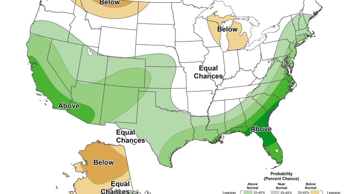
Image via NOAA
Typically on the third Thursday of each month, the National Weather Service’s Climate Prediction Center publishes the latest version of its Seasonal Precipitation Outlook Map. On August 20, 2026, the agency published a new map detailing the precipitation probabilities across the United States for the months of January, February, and March of 2027.
It is important to note that the map was published months in advance, and conditions could certainly change. Still, the new map points to above-average precipitation throughout early 2027. It does not provide any details on whether to expect heavier snowfall or rain across the affected states.
The lighter green regions of the map indicate a 33 to 50% probable chance of above-average precipitation, while the darker green areas indicate a higher than 50% likelihood. Based on the new map, current conditions are pointing to several states leaning toward or likely facing heavier precipitation in early 2027:
The West Coast & Southwest: California, Nevada, Arizona, New Mexico, parts of Oregon, Idaho, and Utah
The South & Southeast: Texas, Louisiana, Florida, South Carolina, parts of Mississippi, Alabama, Georgia, and North Carolina
The Central & Mid-South: Parts of Oklahoma, Arkansas, and Tennessee
The Northeast & Mid-Atlantic: Rhode Island, Connecticut, New Jersey, Delaware, Massachusetts, Washington D.C., Parts of Maryland, West Virginia, Virginia, Pennsylvania, New York, Vermont, New Hampshire, and Maine
The North: A small part of Alaska
On the other hand, there are some states that are leaning toward below-normal rain and snow in early 2027. The light brown areas of the map indicate a 33 to 50% probable chance of below-average precipitation in early 2027. They include parts of Washington, Idaho, Montana, North Dakota, Michigan, and Wisconsin. Additionally, most of Alaska could also see below-average levels of snow and rain.
Currently, the rest of the states fall in the “equal chances” region, which means the models don’t indicate whether they will face average, above-, or below-normal levels of snow and rain.
How This Map Compares to Last Month’s Outlook
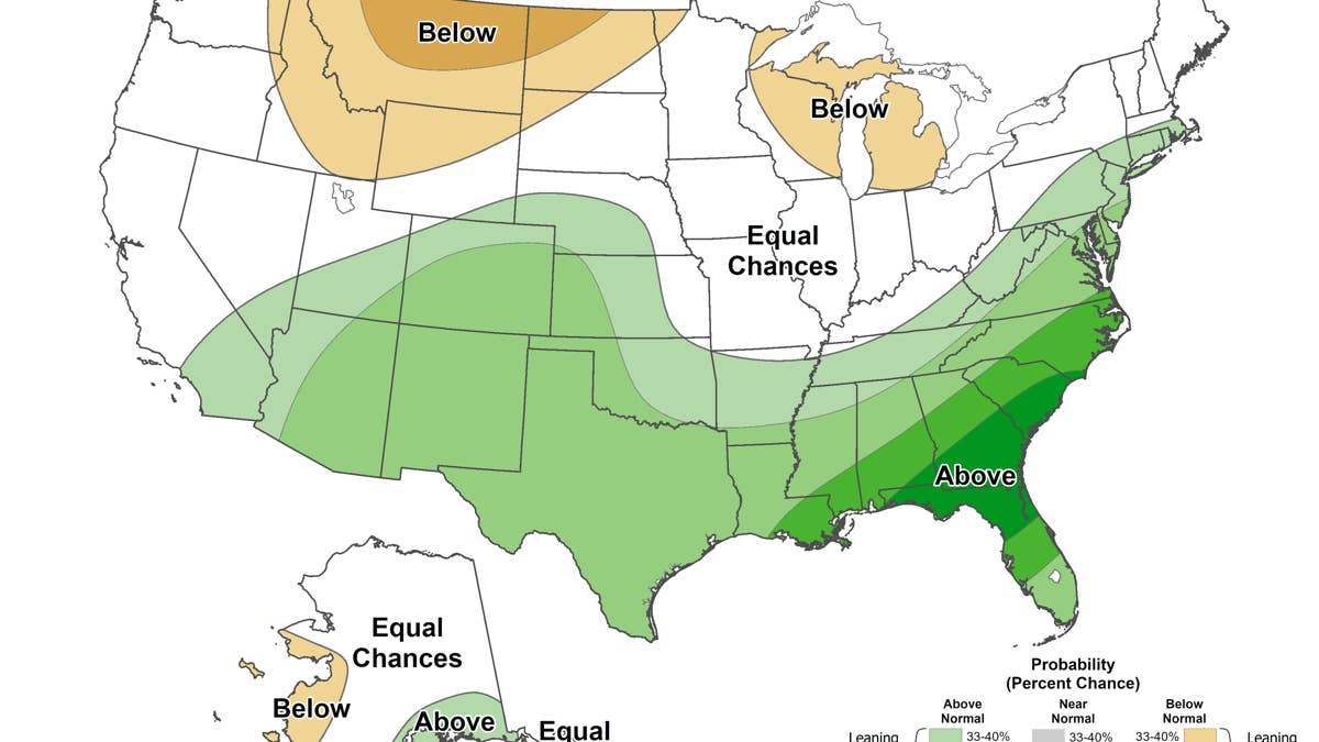
Image via NOAA
Comparing this month’s map to the Climate Prediction Center’s Seasonal Precipitation Outlook Map that was published on July 16, 2026, shows that things have changed. Most obviously, the brown area of the map has shrunk significantly outside of Alaska, where it expanded.
While the green area of the map has shrunk in a handful of states, it has overall expanded to cover much more of the country. The conditions could still change, but that indicates that heavier snow and rain falling in the upcoming winter season are becoming more probable as the year progresses.
Next: Winter Storm Travel Kit Safety Experts Share the Must-Have Items Drivers Often Forget
source https://www.mensjournal.com/news/fresh-winter-map-major-expansion-heavy-snow-rain


Comments
Post a Comment